Old Ordnance Survey Maps of Bradford

  • These detailed maps normally cover an area of about one and a half miles by one mile. Each map includes an introduction.
  • They are available through our On-line Mapshop

  • Here are the details of maps for Baildon Green:

  • Yorkshire Sheet 201.07 Shipley Glen & Baildon Green 1906 - published 2014; intro by Alan Godfrey. ISBN.978-1-84784-806-2

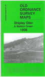
    This detailed map covers the Shipley Glen and Baildon Green area north of Shipley.

    Features include River Aire, Leeds & Liverpool Canal, Trench, Bracken Hall, Prod Lane, Switchback Railway, Shipley Glen Tramway, Saltaire Park, Saltaire Bridge, New Mill, Baildon Green, St Mary's church, Cricketers Arms, The Knoll, Baildon Bank, old coal pits, Hirst Mill etc. An 1889 directory of Baildon is included on the reverse.


    The map links up with sheets 201.06 Bingley, to the west, 201.08 Baildon to the west and 201.11 Shipley to the south.


  • You can order maps direct from our On-line Mapshop. For other information and prices, and other areas, go to The Index Page.
  • Maps in the Godfrey Edition are taken from the 25 inch to the mile map and reduced to about 15 inches to the mile. Follow this link for a complete list of our Bradford maps; or here for the whole Yorkshire series.
    Alan Godfrey Maps, Prospect Business Park, Leadgate, Consett, Co Durham, DH8 7PW / sales@alangodfreymaps.co.uk / 1 June 2023