Old Ordnance Survey Maps of Teesside

  • These detailed maps normally cover an area of about one and a half miles by one mile. Each map includes an introduction.
  • They are available through our On-line Mapshop

  • Here are the details of maps for Linthorpe:

  • Sheet 16.02 Linthorpe & South Middlesbrough 1928 - published 2025; intro by Alan Godfrey. ISBN.978-1-78721-850-5

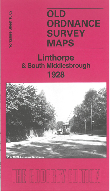
    This detailed map covers Linthorpe, Marton Grove and the southern part of Middlesbrough.

    Features include Albert Park, St Barnabas church, St Mark's church Marton, tramway, Carter Bequest Hospital, Broomlands Cottage Homes, Holgate Poor Law Institution (former workhouse), New Cemetery, Fever Hospital, Kirby School, St Mary's RC College, Toft House, and the streets of houses spreading across Linthorpe.

    On the reverse we include a section of 1st edition six-inch map 16, showing how rural Linthorpe was in 1853, together with a specially written introduction to the history of the area.

  • The map links up with sheet 6.14 Middlesbrough to the north and 16.02 Thornaby Mandale Park to the west.
  • For other information and prices, and other areas, go to The Index Page
  • Maps in the Godfrey Edition are taken from the 25 inch to the mile map and reduced to about 15 inches to the mile. Follow this link for a complete list of our Teesside maps; or here Stockton for a full list of our Stockton maps.
    Alan Godfrey Maps, Prospect Business Park, Leadgate, Consett, Co Durham, DH8 7PW / sales@alangodfreymaps.co.uk / 25 March 2025