Yorkshire Sheet 7.12 Marske-by-the-Sea 1927 - published 2024; intro by Alan Godfrey. ISBN.978-1-78721-800-0 
Our map of Marske is double-sided to give maximum coverage.
One side covers the southern part of the town, including the railway with Marske station, Marske Hall, St Mark's Church, Hummers Hill Farm,
Tofts Farm, village centre and Cross, Erimus Hutments, Gildert Flat etc
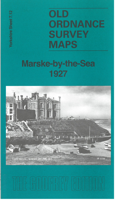
On the reverse we include an extract from adjacent sheet 7.08, which includes St Germain's church, Cliff House, Church Howle, Grundales,
The Aerodrome etc, together with an introduction to the history of Marske.
You can order maps direct from our On-line Mapshop.
For other information and prices, and other areas, go to The Index Page
Maps in the Godfrey Edition are taken from the 25 inch to the mile map and reduced to about 15 inches to the mile.
Follow this link for a complete list of our Teesside maps; or here for the
whole Yorkshire series.
Alan Godfrey Maps, Prospect Business Park, Leadgate, Consett, Co Durham, DH8 7PW / sales@alangodfreymaps.co.uk / 30 September 2024
 Here are the details of maps for Marske: