 Here are the details of maps for Wylam:

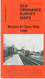
To provide maximum coverage of this area we have used both the Northumberland and Durham sheets for Wylam, which stands on the border between the two counties. Our main map is from the Durham series and coverage stretches from Wylkam village eastward to the pit village of Clara Vale. Coverage extends about half a mile north, including Wylam Rift, and southward to Bradley Mill House. Features include Wylam Bridge, Wylam and North Wylam stations, the Stephenson Arms; the latter is a reminder that George Stephenson was born here, at the High Streethouse cottages. Also shown is Claravale Colliery. On the reverse we include about half of Northumberland sheet 96.06. There is considerable overlap between the two maps, but this one takes coverage further west, to Wylam Hall and West Wylam Junction.
The map connects with sheet 1.12 Ryton to the east.