Old Ordnance Survey Maps of County Durham

  • These detailed maps normally cover an area of about one and a half miles by one mile. Each map includes an introduction.
  • They are available through our On-line Mapshop

  • Here are the details of maps for Ryton:

  • Co Durham Sheet 1.12 Ryton 1895 - published 1993, 2nd Edition 2013; intro by Anthea Lang. ISBN.978-1-84784-710-2

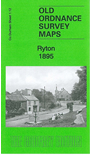
    This detailed map covers the village of Ryton, now part of Gateshead MBC.

    Features include village centre with individual buildings neatly shown, South Grange, Holy Cross church, Elvaston Hall, Run Head (at foot of map), Ryton Grange, River Tyne, Ryton Willows, Newcastle & Carlisle railway with Ryton station, Scotswood, Newburn & Wylam railway with Heddon on the Wall station, Heddon Haughs (at top of map), Ryton Island. We include an 1894 directory of Ryton on the reverse.

    The map connects with Durham sheet 1.11 Wylam to the west and Tyneside sheet 25 Newburn to the east.


  • Follow this link for a complete list of our Durham maps.
  • You can order maps direct from our On-line Mapshop. For other information and prices, and other areas, go to The Index Page.
  • Maps in the Godfrey Edition are taken from the 25 inch to the mile map and reduced to about 15 inches to the mile. For a full list of maps for England, return to the England page.
    Alan Godfrey Maps, Prospect Business Park, Leadgate, Consett, Co Durham, DH8 7PW / sales@alangodfreymaps.co.uk / 14 January 2018