Old Ordnance Survey Maps of Shropshire

  • These detailed maps normally cover an area of about one and a half miles by one mile. Each map includes an introduction.
  • They are available through our On-line Mapshop

  • Here are the details of maps for Buildwas Abbey:

  • Shropshire Sheet 43.13 Buildwas Abbey & Benthall Edge 1901 - published 2024; intro by Barrie Trinder. ISBN.978-1-78721-759-1

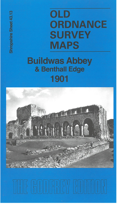
    This detailed map covers the area from Buildwas Abbey eastward to the Albert Edward Bridge.

    Features include Buildwas Abbey ruins, Abbey Hotel, railway with Buildwas Junction station, Wenlock Branch, Abbeygrange Farm, Hungerdale Farm, Meadow Whartf, Strethill Farm, Tick Wood etc. On the reverse we include directory extracts for Buildwas and railway timetables for the Severn Valley and Wenlock lines.


    This map links up with Shropshire Sheet 43.14 Ironbridge to the East


  • Follow this link for a complete list of our Shropshire or Telford maps. For other information and prices, and other areas, go to The Index Page.
  • Maps in the Godfrey Edition are taken from the 25 inch to the mile map and reduced to about 15 inches to the mile. For a full list of maps for England, return to the England page.
    The Godfrey Edition / sales@alangodfreymaps.co.uk / 9 May 2024