
Old Ordnance Survey Maps of Preston
We have published a range of 8 maps for the City of Preston, including some very early Large Scale Plans. This page also includes our maps for South Ribble and for Chorley. Preston was one of the great early cotton towns and during the 19th century it also became an important railway junction. It was the industrial strife here that inspired Dickens' great novel Hard Times. It has often served as the effective county town for Lancashire.
All maps are available from our On-line Mapshop.
For other towns in Lancashire visit our Lancashire page
 Finally, our maps for the City of Preston area:
061.06 Fulwood & Deepdale 1929 - published 2026; intro by Alan Godfrey
061.09a Preston (West) & Ashton on Ribble 1909 - published 1994; intro by Nigel Morgan
061.09b Preston (West) & Ashton on Ribble 1929 - published 2026; intro by Alan Crosby
061.10 Central Preston 1909 - published 1993; intro by Nigel Morgan
061.13 Penwortham 1929 - published 2026; intro by Alan Crosby
We also publish some Large Scale Plans, from the OS 5ft plans, for Preston:
12 Preston: Park Road & St Ignatious 1847-57 - published 2026; intro by Alan Godfrey
16 Preston: Station & Canal 1847-59 - published 2026; intro by Alan Godfrey
17 Preston: Town Centre 1847 - published 2026; intro by Alan Godfrey
 Finally, our maps for the South Ribble and Chorley area:
069.06 Lostock Hall & Farington (N) 1909 - published 2005; intro by David Hunt
069.10 Farington (S) & Leyland (N) 1909 - published 2005; intro by David Hunt
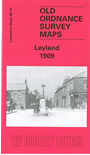
069.14 Leyland 1909 - published 2005; intro by David Hunt
070.16 Darwen 1909 - publ 1988; intro by Mary Painter
077.08 North Chorley 1909 - published 1988; intro by J Heyes
077.12 Chorley 1909 - published 1988, 2nd Edition 2005; intro by Alan Godfrey.
 We also cover the area in our Inch to the Mile maps. These are the principal sheets for the area:
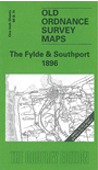
66/74 The Fylde & Southport 1896 - published 2005; intro by Alan Godfrey. Includes a large scale map of Knott End
75 Ribble Estuary 1901 - published 2000; intro by Alan Crosby. Includes a large scale map of Bamber Bridge.
Follow this link for further details of the Inch to the Mile maps.
 Most maps in the Godfrey Edition are taken from the 25 inch to the mile map and reduced to about 15 inches to the mile.
For a full list of English maps, return to the England page
Alan Godfrey Maps, Prospect Business Park, Leadgate, Consett, DH8 7PW. Tel 01207 583388
The Godfrey Edition / sales@alangodfreymaps.co.uk / 9 November 2026