Old Ordnance Survey Inch to the Mile Maps

  • These maps normally cover an area of about 18 miles by 12 miles and are especially good at showing railways, roads and canals, and at giving a broad view of a wider area. Each includes an introduction and a more detailed map of a small town or village. They are available through our On-line Mapshop

  • Here is information about Sheet 126:

  • One Inch Sheet 126 Nottingham & District 1906 - published 2001; intro by Alan Sillitoe. ISBN.978-1-84151-278-5

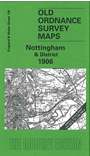
    This One Inch to the Mile map covers Nottingham and the area north and east, with coverage stretching as far as Southwell to the north, Newark to the NE, and Bottesford to the east. The River Trent runs diagonally across the map, and for railway historians there are several lines, many of them now closed, radiating from Nottingham. On the reverse we include a short essay by the author Alan Sillitoe, himself a map-lover, in which he describes flying across the area and choosing place-names on the map for characters in his novels. Hence Aslockton the gamekeeper; and it is Aslockton of which we include a detailed large scale map, complete with directory.


    It is not possible to list the many hamlets, farmsteads and other topographical features shown on these maps. However, you might find it useful if we here list the majority of the principal villages and church parishes that are included on this map. Links are given for those for which detailed large-scale maps are also available.

  • Leicestershire: Bottesford, Muston, Redmile.
  • Nottinghamshire: Alverton, Arnold, Aslockton, Balderton, Bingham, Bleasby, Bulcote, Burton Joyce, Calverton, Car Colston, Carlton, Caythorpe, Cotham, Cropwell Bishop, Cropwell Butler, East Bridgeford, East Stoke, Elston, Elton, Epperstone, Farndon, Flawborough, Flintham, Gamston, Gedling, Gonalston, Granby, Gunthorpe, Halloughton, Hawksworth, Hawton, Holme Pierrepont, Hoveringham, Kilvington, Kneeton, Lambley, Lowdham, Newark upon Trent, Nottingham, Old Basford, Old Radford, Orston, Oxton, Papplewick, Radcliffe upon Trent, Rolleston, Saxondale, Scarrington, Screveton, Shelford, Shelton, Sibthorpe, Southwell, Staunbton in the Vale, Staythorpe, Stoke Bardolph, Syerston, Thoroton, Thorpe, Thurgarton, Tythby, Upton, West Bridgford, Whatton, Woodborough.

    Index maps are available showing the areas covered by the Inch to the Mile maps. Go to This page


    You can order maps direct from our On-line Mapshop. For a full list of Inch to the Mile maps go to the Inch to the Mile page, where you will also find details of prices. For information on the rest of the series, go to The Index Page.


    Alan Godfrey Maps, Prospect Business Park, Leadgate, Consett, Co Durham, DH8 7PW / sales@alangodfreymaps.co.uk / 16 April 2011
    >