
 Here are the details of maps for south Hucknall:

This detailed map is double-sided for maximum coverage.
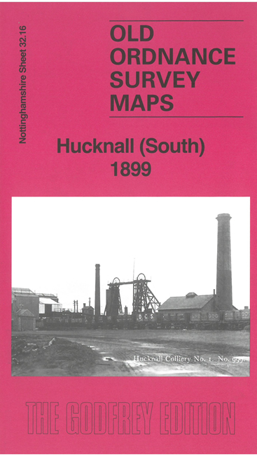
The main map covers the southern part of the town, known as Hucknall Torkard, including St Peter's church, chapels and schools. The Great Central Railway runs through the map and includes its station, with a branch to Hucknall Colliery No.1. The hamlet of Hazelgrove is shown, plus some farms.
On the reverse we include a large extract from adjacent sheet 33.13 extending coverage eastward to include Hucknall Colliery No.2, St John's church, the Midland and GNR railways, Butler's Hill station, Broomhill, Butler's Hill etc. The map includes an introduction by Barrie Trinder discussing the town's growth and economy. Paired with its companion map to the north, this provides an invaluable guide to Hucknall's history.