Old Ordnance Survey Maps of Nottinghamshire

  • These detailed maps normally cover an area of about one and a half miles by one mile. Each map includes an introduction.
  • They are available through our On-line Mapshop

  • Here are the details of maps for north Newark:

  • Notts Sheet 30.16 Newark (North) 1899 - published 2025; intro by Barrie Trinder. ISBN.978-1-78721-865-9

    This detailed map is double-sided for maximum coverage.

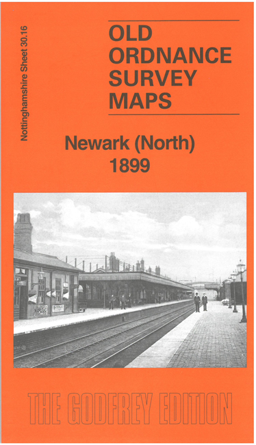
    This map covers the railway network at the north of Newark, including the GNR station, the northern part of the Midland station, and the railway crossing. Other features include Wellington Foundry, malthouses, brewery, River Trent, chemical manure works, St Leonard's church, with coverage eastward to Coddington Hall. Though the sheetlines are awkward, the map greatly improves our coverage of Newark.

    The map links up with companion sheets 35.03 Newark and 35.04 Newark East to the south.


  • Follow this link for a complete list of our Nottinghamshire Series maps. For other information and prices, and other areas, go to The Index Page.
  • Maps in the Godfrey Edition are taken from the 25 inch to the mile map and reduced to about 15 inches to the mile. For a full list of maps for the East Midlands, return to the East Midlands page.
    The Godfrey Edition / sales@alangodfreymaps.co.uk / 30 May 2025