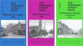

 Here are details of our map for Griffithstown:
This detailed map covers the southern part of Griffithstown, near Pontypool, and the map is split between Panteg and Llanfrechfa Upper parishes. Coverage stretches from Mary Street, Griffithstown, southward a mile. Pontrhydrun station is just off the map at the south. The main feature is the complex of steelworks, including Panteg Steel Works, Panteg Sheet & Galvanizing Works and Panteg Foundry, including their railway lines and stretches of the GWR Hereford & Newport and Monmouthshire Eastern Valleys Line either side. Other features include station, Sebastopol, Panteg House, Cwrdy Farm, St Oswald's Mission Church, Monmouthshire & Brecon Canal, Panteg Junction, Penyrheol. On the reverse we include directories of Griffithstown and Sebastopol in 1905.
The map links up with sheet 23.07 Pontypool South to the north.