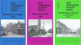

 Here are details of our map for south Pontypool:
This detailed map covers the southern part of Pontypool, with coverage stretching from Crane Street station southward to Griffithstown High Street, and from Sowhill eastward to The High Way. Features include Cwm Fields, Trosnant, Glanwern, Trosnant Lodge, Cwmniscoy, Mount Pleasant, West Monmouthshire School, Pontypoile, Lower Mills Sheet Works, Phoenix Galvanising Works, Pontypool Workhouse; numerous railways with engine shed, Crane Street station, Clarence Street station, part of Pontypool Road station (at eastern edge of map), Panteg Cemetery etc. On the reverse we include part of a commercial directory for Pontypool, entries A-M.
The map links up with sheet 18.15 Pontypool North to the north, 23.07 Griffithstown South to the south.