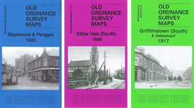
Old Ordnance Survey Maps of Monmouthshire

  • These detailed maps normally cover an area of about one and a half miles by one mile. Each map includes an introduction.
  • They are available through our On-line Mapshop

  • This is our map for Ebbw Vale (South):

  • Monmouthshire Sheet 11.14 Ebbw Vale (S) 1899 - published 2012; intro by Derrick Pratt. ISBN.978-1-84784-634-1

    This detailed map covers the southern part of Ebbw Vale, with coverage stretching from Chapel Row and the Upper Mills southward to Victoria Foundry.

    Features include Christ Church, Upper Mills, Victoria Colliery, Briery Hill area, steelworks, Bath Terrace, Lethbidge Terrace, Ebbw River, GWR Western Valleys railway, Coppee Coke Ovens, several old coal shafts, Drysiog Farm, many industrial sidings and railway lines, reservoirs etc.

    On the reverse we include a contemporary directory for Briery Hill plus a 1906 GWR timetable for the Newport to Ebbw Vale line.

    The map links up with sheet 11.10 Ebbw Vale N to the north and 11.13 Tredegar (S) to the west.


  • Follow this link for a complete list of our Monmouthshire Series maps.
  • You can order maps direct from our On-line Mapshop. For other information and prices, and other areas, go to The Index Page.
  • Maps in the Godfrey Edition are taken from the 25 inch to the mile map and reduced to about 15 inches to the mile. For a full list of maps for Wales, return to the Wales page.
    The Godfrey Edition / sales@alangodfreymaps.co.uk/A> / 21 November 2017