Old Ordnance Survey Maps of Monmouthshire

  • These detailed maps normally cover an area of about one and a half miles by one mile. Each map includes an introduction.
  • They are available through our On-line Mapshop

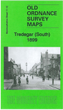
  • Here are the details of maps for Tredegar (S):

  • Monmouthshire Sheet 11.13 Tredegar (South) 1899 - published 2012; intro by Derrick Pratt. ISBN.978-1-84784-625-9

    This very detailed map covers the southern part of Tredegar, from Red Lion Square and Queen Square southward to Ty-trist Colliery and Pochin Crescent.

    Features include Whitworth Coal Pits, Whitworth Terrace, Bedwellty House, Ty-trist Colliery, George Town, Mount Pleasant, Water Works, Siloh Chapel, Bedwellty Union Workhouse, cemetery, Mountain Pit (disused), The Circle, Capel Saron, LNWR Sirhowy Branch with station and engine shed, coke ovens, railway sidings, Whitworth Coal Drift etc. We include extracts from a 1906 directory on the reverse.

    The map links up with sheet 10.16 Rhymney North to the west, 11.09 Tredegar N to the north and 11.14 Ebbw Vale S to the east


  • Follow this link for a complete list of our Monmouthshire Series maps.
  • You can order maps direct from our On-line Mapshop. For other information and prices, and other areas, go to The Index Page.
  • Maps in the Godfrey Edition are taken from the 25 inch to the mile map and reduced to about 15 inches to the mile. For a full list of maps for Wales, return to the Wales page.
    The Godfrey Edition / sales@alangodfreymaps.co.uk/A> / 21 November 2017