
 Here are the details of maps for Ruislip (N):

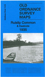
This detailed map covers the northern part of Ruislip and part of Eastcote. Coverage stretches from Ruislip Common southward to Ladygate Lane and eastward to Haydon Hall and Eastcote Lodge.
Features include High Grove, St Michael's School, Haydon Hall, Ruislip Common area, Ruislip Reservoir, Park Wood, Bury Street area. On the reverse we include Eastcote directory entries for 1890 and 1933.
The map links up with Middlesex Sheets 10.01 Northwood Hills to the north, 10.06 Pinner N to the east, 10.09 Ruislip to the south.
 Follow this link for a list of our maps for the London Borough of Hillingdon, or here for a complete list of our London maps .