Old Ordnance Survey Maps of Enfield and Middlesex

  • These detailed maps maps normally cover an area of about one and a half miles by one mile. Each map includes an introduction. The Middlesex maps link up with those for London to form a major series for the Greater London area. They are available through our On-line Mapshop

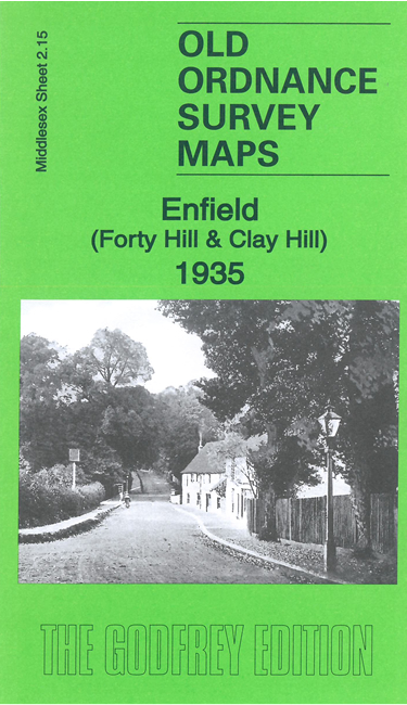
  • Here are the details of maps for Enfield Forty Hill:

  • Middlesex 2.15 Enfield (Forty Hill & Clay Hill) 1935 - published 2021; intro by Pamela Taylor. ISBN.978-1-78721-403-3

    This map covers the area north of Enfield that includes Forty Hill and Clay Hill.

    Features include Myddelton House, Null's Cross, Capel House, Forty Hall, Whitewebbs, Whitewebbs Park, Clayhill, Hill Fields Park.

    The map links up with Middlesex Sheets 02.16 Enfield Wash to the east, 07.03 Enfield North to the south.


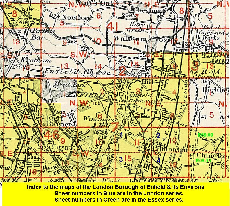
  • Follow this link for a list of our maps for the London Borough of Enfield, or here for a complete list of our London maps .
  • You can order maps direct from our On-line Mapshop. For other information and prices, and other areas, go to The Index Page.
  • Maps in the Godfrey Edition are taken from the 25 inch to the mile map and reduced to about 15 inches to the mile. For a full list of maps for England, return to the England page.
    Alan Godfrey Maps, Prospect Business Park, Leadgate, Consett, Co Durham, DH8 7PW / sales@alangodfreymaps.co.uk / 13 January 2021