
 Here are the details of maps for Lower Sydenham:

We have published just the one map for this area. The map is centred on Lower Sydenham and covers the area from Sydenham station on the LBSCR line eastward to Lower Sydenham station on the SER 'Mid Kent' line, and a little beyond; also from Bampton Road and Houston Road southward to Woodbastwick Road. Apart from the two railways, features on the map include Sydenham Road, Bell Green, the Crystal Palace Gas Works. On the reverse are street directory entries for Bell Green, Champion Park, Fairlawn Park, Mayow Road, Paxton Park, Perry Rise, and Sydenham Road.
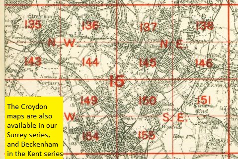
The map links up with London Sheets 128 Forest Hill to the north, 137 Upper Sydenham to the west, 170 Southend Village to the east, and 146 Beckenham to the south.
 Follow this link for a complete list of our London maps .