Old Ordnance Survey Town Plans of London

  • These highly detailed maps, at a scale of 1:1760 or a Yard to the Mile, cover parts of central London in exceptional detail. They are available through our On-line Mapshop

  • Here are the details of the map for Bow:

  • London Large Scale Sheet 08.31 Bow 1867-93 - published 2025. Intro by Tony Kirby. ISBN.978-1-78721-833-8

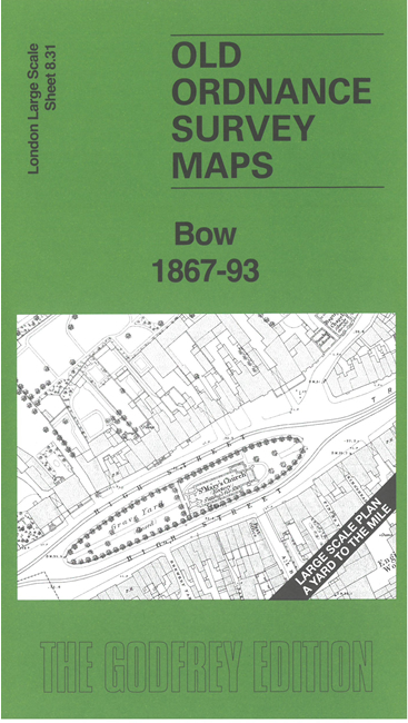
    This very detailed map covers the area around and to the north of Bow High Street and Bow Bridge.

    Features include St Mary's church, tramways, Bow Brewery, River Lea, Lamp Manufactory, Five Bells Bridge, Grove Hall Lunatic Asylum, Fairfield match works, Crinoline Manufactory, East London Waterworks, railway, Waterproof Cloth Manufactory, Lloyds Paper Mills, Pudding Mill River, City Mill River, Three Mills Back River, Pegs Hole Bridge, numerous other works, etc. The later map also includes the North London Railway's Bow station.


  • For other Town Plans go to the London Town Plans page. Here is an Index Grid
  • For a full list of maps for London and Middlesex, return to the London page.
  • For other information and prices, and other areas, go to The Home Page.
    Alan Godfrey Maps, Prospect Business Park, Leadgate, Consett, DH8 7PW. Tel 01207 583388
    The Godfrey Edition / sales@alangodfreymaps.co.uk / 6 March 2025