
 Here are the details of the map for the London Bridge Station area:

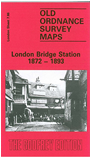
This highly detailed map at a 'Yard to the Mile' scale is dominated by London Bridge station, most of which is shown here in detail, with track layout, signal posts, turntable etc. However there is much else of interest on this busy map. Features include Bermondsey Leather Market, tanneries, Black Eagle Brewery, Bermondsey Workhouse and St Olave's Union Workhouse (both shown in detail), Queen Elizabeth's Grammar School, St John's church, Tooley Street, wool and hop warehouses, St Paul's church Nelson Street, Pickford's Stables, site of Marshalsea Prison, Guys Hospital (shown in detail). By way of contrast, on the reverse we include the 1893 map for the same area, at a slightly smaller scale.
The map links up with sheets 7.76 Monument to the north, 7.75 Bankside to the west, 7.87 Bermondsey NE to the east and 7.96 Bermondsey W to the south.