
 Here are the details of the map for the Regent Street area:

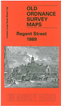
This highly detailed map at a 'Yard to the Mile' scale covers the area around Oxford Circus and Regent Street, including the west part of Soho. Coverage stretches from New Bond Street eastward to Wardour Street, and from Cavendish Square southward to Golden Square. Oxford Street runs through the map, including Oxford Circus (then 'Regent Circus North'). Features include St James Westminster Workhouse, Corinthian Bazaar, 'Abp Tennison's Chapel', Oxford Market, St George's church, Hanover Square, Hanover Church, Ingestre Buildings, St Luke's church Berwick Street, Soho Bazaar. On the reverse we include street directory entries for Broad Street, Conduit Street, George Street, Great Marlborough Street, Golden Square, Hanover Square, Wardour Street in 1859.
The map links up with Sheets 7.52 Langham Place to the north, 7.63 Covent Garden to the east, 7.72 Piccadilly to the south.