Old Ordnance Survey Maps of London

  • These detailed maps maps normally cover an area of about one and a half miles by one mile. Each map includes an introduction. The London maps link up with those for Middlesex to form a major series for the Greater London area. They are available through our On-line Mapshop

  • Here are the details of maps for South Croydon :

  • London Sheet 159 South Croydon 1895 - published 2014; intro by Richard Oliver. ISBN.978-1-84784-805-5

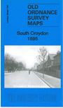
    This detailed map covers much of South Croydon, with coverage stretching from Warham Road and St Peter's church southward to Sanderstead Road and Wyche Grove.

    Features include railways with South Croydon and Selsdon Road stations, Haling Road Hall, tramways, cattle market, Haling Grove, Haling Park, St Augustine's church, Pampisford Road, Crunden Place, Coldharbour Lane, Mere Bank etc. On the reverse we include some extracts from a 1934 street directory and a 1908 timetable for the Woodside to Selsdon Rd railway.

    The map links up with London sheets 157 Croydon to the north and 160 Addington Hills to the east.


  • Follow this link for a complete list of our Croydon maps.
  • You can order maps direct from our On-line Mapshop. For other information and prices, and other areas, go to The Index Page.
  • Maps in the Godfrey Edition are taken from the 25 inch to the mile map and reduced to about 15 inches to the mile. For a full list of maps for England, return to the England page.
    Alan Godfrey Maps, Prospect Business Park, Leadgate, Consett, Co Durham, DH8 7PW / sales@alangodfreymaps.co.uk / 5 February 2018