
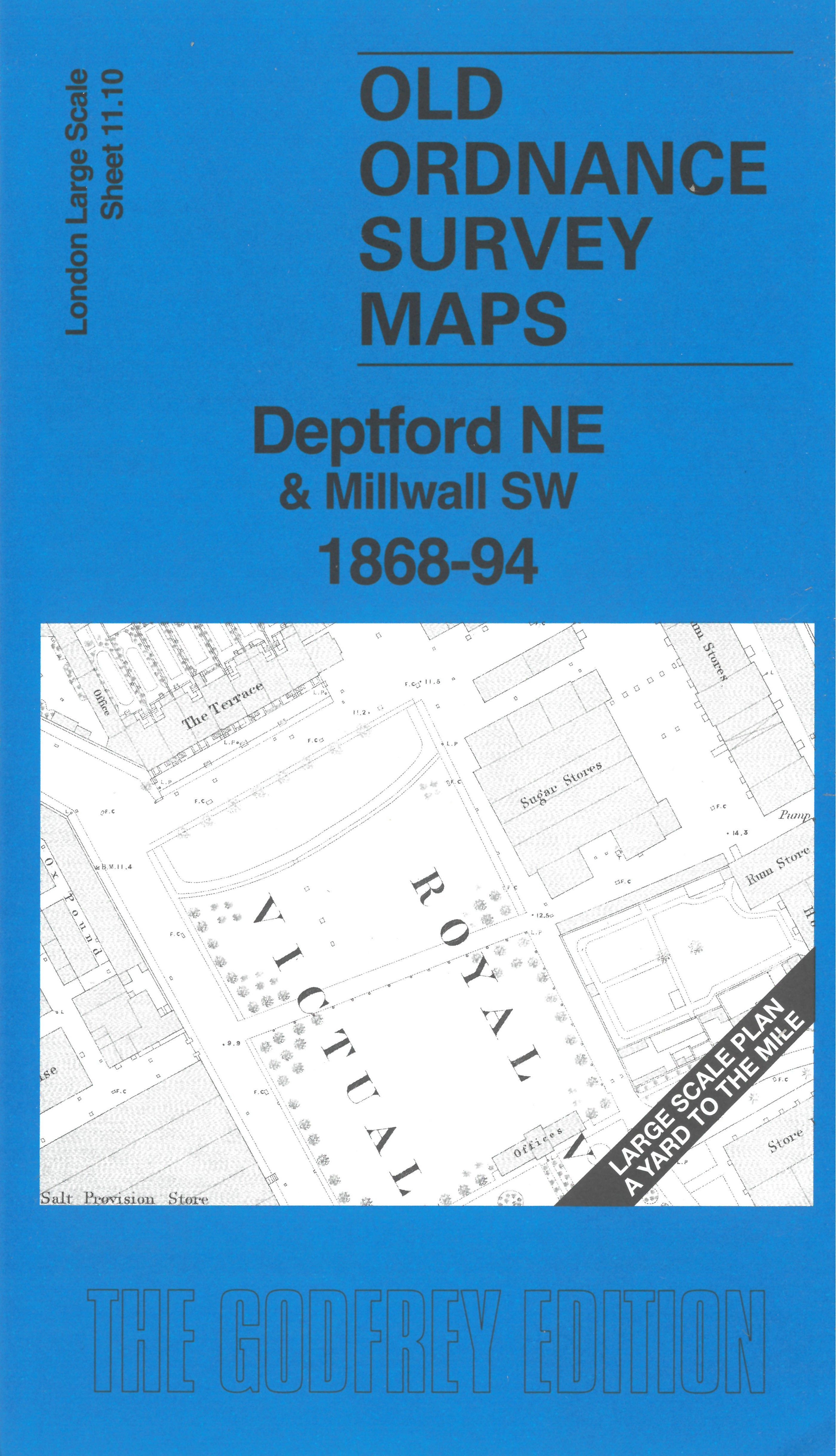
 Here are the details of the map for Deptford NE:

This very detailed map covers the northern part of Deptford around the Royal Victoria Victualling Yard. Features include the Victualling Yard shown in detail with various store buildings - Salt Provision Store, Rum Stores, Chocolate Mill, Ox Slaughter House etc - and the Cooperage. Further north is the Wet Dock, Thames Junction Branch railway to Deadman's Dock, St George's Wharf. Across the river are West Ferry Road and various riverside wharves and works, including Chain and Anchor Works, Phoenix Iron Works, Britannia Dock.
On the reverse we include the 1894 map, showing the same area at a later stage. We also include an introduction to the history of the area.
The map links up with sheet 11.09 Rotherhithe South to the west and 11.20 Deptford Royal Dockyard to the south.
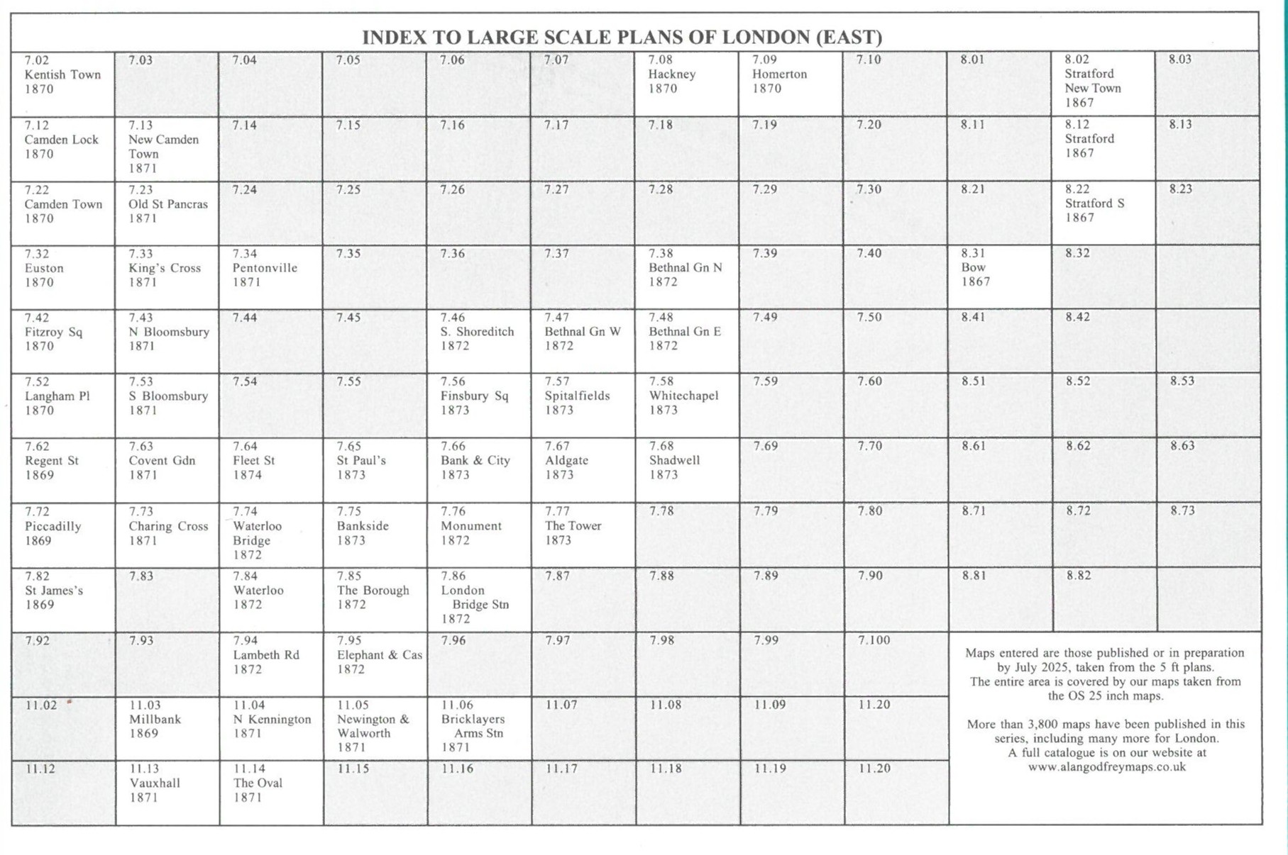