Old Ordnance Survey Town Plans of London

  • These highly detailed maps, at a scale of 1:1760 or a Yard to the Mile, cover parts of central London in exceptional detail. They are available through our On-line Mapshop

  • Here are the details of the map for west Chelsea

  • London Large Scale Sheet 10.29 Chelsea Creek 1865-95 - published 2024. Intro by Alan Godfrey. ISBN.978-1-78721-797-3

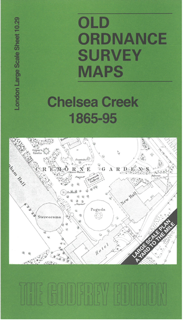
    This very detailed map covers parts of west Chelea and east Fulham.

    Features include Cremorne Gardens, Ashburnham Hall, Ashburnham House, nurseries, Imperial Gas Works, Dudmaston House, St Mark's College, King's Road, West London Extension Railway with Chelsea station, etc. Across the river is a small area of Battersea including St Mary's Church.

    On the reverse we include the 1895 map of the same area, now including St John's Church plus numerous wharves on the river. A 2,000 word introduction is also included.


  • For other Town Plans go to the London Town Plans page. Here is an Index Grid
  • For a full list of maps for London and Middlesex, return to the London page.
  • For other information and prices, and other areas, go to The Home Page.
    Alan Godfrey Maps, Prospect Business Park, Leadgate, Consett, DH8 7PW. Tel 01207 583388
    The Godfrey Edition / sales@alangodfreymaps.co.uk / 30 August 2024