Old Ordnance Survey Maps of Liverpool

  • These detailed maps normally cover an area of about one and a half miles by one mile. Each map includes an introduction.
  • They are available through our On-line Mapshop

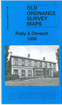
  • Here are the details of maps for Roby:

  • Lancashire Sheet 107.09 Roby & Dovecot 1906 - published 2014; intro by Kay Parrott. ISBN.978-1-84784-840-6

    This detailed map covers the area from Dovecot House and Thingwall Hall eastward to Roby station.

    The map covers an area at the edge of Liverpool, with features including railway with Roby station (in SE corner of map), St Bartholomew's church, Church Road, Page Moss Farm, Horn Smithies, tramway, Huyton Farm, Thingwall Hall, Dovecot House, Carmel Convent, Mill Yard etc.

    This map links up with sheet 106.12 Old Swan to the west, 107.10 Huyton to the east, 107.13 Childwall to the south.


  • Follow this link for a complete list of our Liverpool or Sefton maps.
  • You can order maps direct from our On-line Mapshop. For other information and prices, and other areas, go to The Index Page.
  • Maps in the Godfrey Edition are taken from the 25 inch to the mile map and reduced to about 15 inches to the mile. For a full list of maps for the North West, return to the North West page.
    The Godfrey Edition / sales@alangodfreymaps.co.uk / 18 January 2018