
 Here are the details of maps for Oldham East:

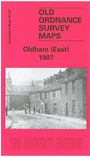
This very detailed map covers the eastern side of Oldham, with coverage stretching from Greenacres Hill and Kelverlow Street eastward to Stone Breaks and Shelderslow; and from Waterworks Road southward to Lees station. Areas include Bank Top, Crossbank, Shelderslow, Austerlands, Greenacres, Hey, Greenacres Fold, Birks, Taylor Green, Waterhead, Spring Hill. Features include tramways, Greenacres Cemetery, Stamford Mill, Owl Mill, Banktop Mills, engine shed (at Lees station), Dowry Mill, St John the Baptist church, Brookside Mills (in bottom right corner), Birks Quarry, Majestic Mill, Cairo Mill, Glen Mill, Prince of Wales Mill, football ground, Ruby Mill, Newbreck Mills, several other mills, Sun Hill, etc. Note that the Austerlands and Shelderslow area was in Yorkshire. On the reverse we include street directory entries for Greenacres Road, Huddersfield Road, Ripponden Road, Spring Street.
The map links up with sheets 97.06 Oldham to the west, 97.11 Lees to the south.