
 Here are the details of maps for Platt Bridge:

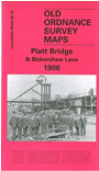
This highly detailed map covers an area SE of Wigan, showing the area from Warrington Road eastward to Bickershaw Lane. The map was divided between Hindley, Abram and Ince in Makerfield councils. Features include a stretch of the GCR Wigan Junction Branch with Bickershaw & Abram station, a stretch of the LNWR Eccles & Wigan line with Platt Bridge station, several spurs and junctions, part of the LNWR West Leigh Line, Hindley Field Collieries, Victoria Collieries, Low Hall Collieries, Brookside Colliery, Wigan Junction Colliery, tramways with tram shed at Platt Bridge, Leyland Park, Hussey House Colliery (disused), etc. On the reverse we include a directory of Platt Bridge, plus an 1897 timetable for the Manchester-Tyldesley-Wigan line.
The map links up with sheets 94.09 Hindley to the north, 93.16 Ince Moss to the west, 94.14 Hindley Green to the east and 102.01 Abram to the south.