Old Ordnance Survey Maps of Lancashire

  • These detailed maps normally cover an area of about one and a half miles by one mile. Each map includes an introduction.
  • They are available through our On-line Mapshop

  • Here are the details of maps for Ormskirk (N):

  • Lancashire Sheet 84.13 Ormskirk (North) 1907 - published 2004; intro by Jennifer Lewis. ISBN.978-1-84151-648-6

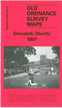
    This detailed map covers the northern half of Ormskirk, with coverage stretching from Derby Street northward to Brooklands, along High Lane to Sycamore House, and eastward to Dark Lane. Features include railways with station, engine shed and junction with the Skelmersdale Branch; parish church, Cottage Hospital, The Quarry, Isolation Hospital, Burscough Street, Bath Wood, Charlesbye. On the reverse we include a list of private residents from a 1918 directory, plus railway timetables for the Ormskirk - St Helens, and Liverpool-Ormskirk-Southport lines in 1914.

    The map links up with Lancashire Sheets 92.01 Ormskirk South to the south.


  • Follow this link for a complete list of our Liverpool or Sefton maps.
  • You can order maps direct from our On-line Mapshop. For other information and prices, and other areas, go to The Index Page.
  • Maps in the Godfrey Edition are taken from the 25 inch to the mile map and reduced to about 15 inches to the mile. For a full list of maps for the North West, return to the North West page.
    The Godfrey Edition / sales@alangodfreymaps.co.uk / 17 January 2018