
 Here are the details of maps for Fareham:

We have published two maps for Fareham. These link up with each other to give excellent detailed coverage of the town. The railway station is split between the two maps.
Sheet 75.05 covers the northern part of the town together with part of Wallington. Features include Fareham Junction, Maylings House, Maylings Farm, Brook Farm, Uplands, Fareham Pottery, Furzehall Farm, brickworks, cemetery, Public Assistance Institution (former workhouse), Wallington Tannery, Price's School, St Peter & St Paul's church, most of High Street, The Old Manor, Wallington Bridge, North Wallington, part of Fort Wallington, part of railay station, etc.
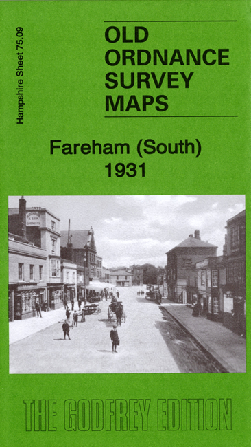
Sheet 75.09 covers the southern part. Features include West Street, East Street, part of railway station, Alders Farm, Bishopswood, Holy Trinity church, cattle market, Ropewalk Fields, Lower Quay, Salterns Quay, Town Quay, Cams Hall (part), Bathinghouse Grove, Upper Quay, Fareham House, etc. A major feature is Fort Fareham, here shown in considerable detail.
We include extracts from a 1927 directory together with a specially written introduction to the history of the area on each map.