Old Ordnance Survey Maps of Hampshire

  • These detailed maps normally cover an area of about one and a half miles by one mile. Each map includes an introduction.
  • They are available through our On-line Mapshop

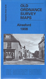
  • Here are the details of maps for Alresford:

  • Hampshire Sheet 42.06 Alresford 1908 - published 2017; intro by Tony Painter. ISBN.978-1-78721-100-1

    This detailed map is double-sided for maximum coverage.

    The main map covers the centre of the town and area to the east. Features include St John's church, West Street, East Street, Broad Street, Old Alresford Pond, St Mary's church Old Alresford (at top of map), Old Alresford House, Weir House, The Soke, railway with station, Western Court Farm.

    On the reverse we include part of adjacent map 42.05 extending coverage westward to include The Dean, Arle Bury, Pinglestone Farm, Old Fulling Mill.


  • Follow this link for a complete list for Hampshire.
  • You can order maps direct from our On-line Mapshop. For other information and prices, and other areas, go to The Index Page.
  • Maps in the Godfrey Edition are taken from the 25 inch to the mile map and reduced to about 15 inches to the mile. For a full list of maps for England, return to the England page.
    Alan Godfrey Maps, Prospect Business Park, Leadgate, Consett, Co Durham, DH8 7PW / sales@alangodfreymaps.co.uk / 12 January 2018