Old Ordnance Survey Maps of Glamorgan

  • These detailed maps normally cover an area of about one and a half miles by one mile. Each map includes an introduction.
  • They are available through our On-line Mapshop

  • Here are the details of maps for Maesteg:

  • Glamorgan 26.09 Maesteg 1914 - published 2019; intro by Ray Lawrence. ISBN.978-1-78721-213-8

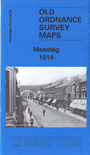
    This detailed map gives excellent coverage of Maesteg with its town centre, railways and old colliery workings.

    Features include town centre with individual buildings neatly shown, Maesteg Merthyr Colliery, GWR Bridgend and Abergwynfi railway with station, North's Navigation Railway, Port Talbot Railway with station, St David's church, chapels, Maesteg Deep Colliery, tramways, numerous old coal levels, etc

    The map links up with sheet 26.05 Nantyffyllon to the north.


  • Follow this link for a complete list of our Glamorgan maps.
  • You can order maps direct from our On-line Mapshop. For other information and prices, and other areas, go to The Index Page.
  • Maps in the Godfrey Edition are taken from the 25 inch to the mile map and reduced to about 15 inches to the mile. For a full list of maps for Wales, return to the Wales page.
    The Godfrey Edition / sales@alangodfreymaps.co.uk / 7 February 2019