
 Here are the details of maps for west Swansea:

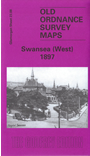
This highly detailed map covers the western part of Swansea, with coverage stretching from St James's church and Swansea Hospital westward to Sketty and Delabeche Terrace.
Features include Swansea Hospital, St James church, Bryn-y-mor, Cwmdonkin Park, Brynmill Park, Brooklands, Townhill (to the north), Parc-wern, St Paul's church, Sketty, Sketty House, Hill House. The map is notable for a large number of detached houses and author Steph Mastoris discusses several of them in his introduction.
The map links up with sheet 23.04 Swansea NW to the north, 24.05 Swansea to the east and 23.12 Brynmill to the south.