 Here are the details of our map for St Leonards:

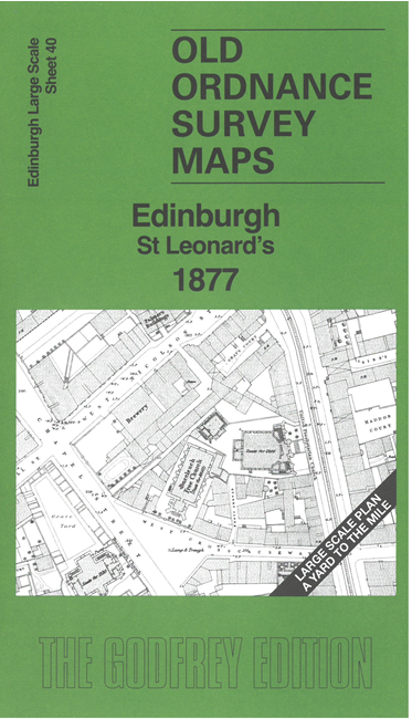
This highly detailed map covers the area between George Square and St Leonards. The many features include Archer's Hall, Buccleuch Church, Buccleuch Free Church, United Presbyterian Church, tramways, breweries, printing works, Newington Church, St Peter's Chapel, Newington Free Church, Edinburgh Literary Institute, St Paul's Free Church, St Leonard's Brewery, St Leonards Station and Goods Depot, Park Brewery. Unusually for such a large scale map it is contoured.
On the reverse we include 1:500 sheet III.12.2 covering St Leonards station at a later date.
The map links up sheet 36 South Bridge to the north and 39 Lauriston to the west.