
 Here are the details of maps for Exeter:


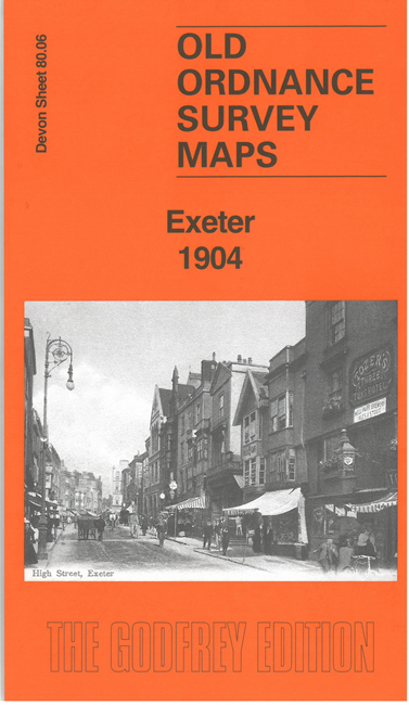
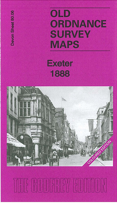
We have published two versions of this detailed map, which covers most of central Exeter and its eastern suburbs, with coverage stretching from Bonhay Road eastward to Cemetery Road, and from Prospect Park southward to Commercial Road and Friars Green. The 1888 version is in colour.
Features include LSWR railway with Queen Street (now Central) station; Cathedral, Exe Island, city centre with individual buildings neatly shown, Lower Cemetery (disused), Mount Dinham, Headweir Mills, Bull Meadow, Royal Devon & Exeter Hospital, Mount Radford, Exeter Castle, Town Barracks, St Michael & All Angels church, Brewery, schools, St Matthew's church, Eye Infirmary, Lower Market, Allhallows church, St David's church, Bury Meadow, Higher Market, Exeter Diocesan Training College, Workhouse, Newtown area, Polsloe Park, Polsloe Priory area, Belmont Leisure Ground, St Sidwell's church, chapels, Lion's Holt, Reformatory for Girls, etc. (Note that St David's station is off the map.)
Each of the maps includes extracts from an early street directory. The 1888 version is colour printed, taken from the Ordnance Survey's beautiful handcoloured First Edition.
The maps link up with sheet 80.05 Exeter West to the west, 80.07 Exeter East to the south and 80.10 Exeter South to the south.