Old Ordnance Survey Maps of Devon

  • These detailed maps normally cover an area of about one and a half miles by one mile. Each map includes an introduction.
  • They are available through our On-line Mapshop

  • Here are the details of maps for Tiverton:

  • Devon Sheet 45.07 Tiverton 1903 - published 2005; intro by Richard Oliver. ISBN.978-1-84151-754-4

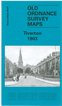
    This detailed map covers the centre and south of Tiverton, with coverage stretching from St Peter's church southward to Howden Court, and from Gotham eastward to The Avenue.

    Features include GWR Exe Valley Branch with station, St Peter's church, St Paul's church, River Exe, Cranmore Castle camp, Collipriest, Little Silver area, St George's church, Howden Lace Factory, Cattle Market, Cold Harbour area, Brewery, Old Blundells, The Firs, Castlebarn, Town Hall, town centre with individual buildings neatly shown, Loman Bridge, River Loman etc.

    On the reverse we include extracts from a 1906 directory, listing private residents, plus a timetable for the Exeter-Tilverton-Dulverton and Tiverton Branches.


  • Follow this link for a list of our maps for Devon county, Plymouth, or Torbay; or here for a general list for the South West.
  • You can order maps direct from our On-line Mapshop. For other information and prices, and other areas, go to The Index Page.
  • Maps in the Godfrey Edition are taken from the 25 inch to the mile map and reduced to about 15 inches to the mile. For a full list of maps for England, return to the England page.
    Alan Godfrey Maps, Prospect Business Park, Leadgate, Consett, Co Durham, DH8 7PW / sales@alangodfreymaps.co.uk / 13 January 2018