
H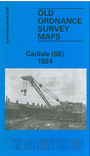 ere are the details of maps for Carlisle (SE):

This detailed map covers the SE area of Carlisle, with coverage stretching from Cecil Street eastward to Durranhill Park and southward to Millholme Avenue.
Features include eastern end of Citadel station with railway approaches, numerous junctions incl start of lines to Settle and Newcastle, LMSR engine shed and carriage shed, LNER engine shed, Petteril Bridge Goods Station, Durranhill Sidings, LMSR engine shed (for Settle line), Harraby, Harraby Green, Auction Mart, Albion Mills, Christ Church, Palace Theatre, tramways, Fusehill House Poor Law Institution, Botchergate area, St Nicholas Works, etc.
On the reverse we include a selection of street directory entries, incl Lindisfarne Street, Petteril Terrace, Sybil Street, Thomson Street.
The map links up with Cumberland sheet 23.04 Carlisle NE to the north, 23.07 Carlisle SW to the west.