Old Ordnance Survey Maps of Cumberland

  • These detailed maps normally cover an area of about one and a half miles by one mile. Each map includes an introduction.
  • They are available through our On-line Mapshop

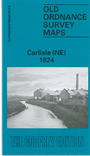
  • Here are the details of maps for Carlisle (NE):

  • Cumberland Sheet 23.04 Carlisle (NE) 1924 - published 1990; intro by Robert Bell. ISBN.978-0-85054-341-4

    This detailed map covers the NE area of Carlisle, with coverage extending from Cecil Street and Spencer Street eastward to Tilbury Road, and from Portland Square northward to Rickerby Park.

    Features include Warwick Road area, Brunton Place, football ground, Botcherby, part of Aglionby Ward, St Andrew's Mission church, St Paul's church, Chatsworth Square, Stony Holme, River Eden, Rickerby, Rickerby House, etc.

    On the reverse we provide a bonus map, the Inch to the Mile map for the area east of Carlisle in 1895, covering the area from Carlisle's eastern suburbs eastward to Slaggyford and northward to Gilsland.

    The map links up with Cumberland sheet 23.03 Carlisle NW to the west, 23.08 Carlisle SE to the south.


  • Follow this link for a complete list of our Cumberland Series maps.
  • You can order maps direct from our On-line Mapshop. For other information and prices, and other areas, go to The Index Page.
  • Maps in the Godfrey Edition are taken from the 25 inch to the mile map and reduced to about 15 inches to the mile. For a full list of maps for England, return to the England page.
    Alan Godfrey Maps, Prospect Business Park, Leadgate, Consett, Co Durham, DH8 7PW / sales@alangodfreymaps.co.uk / 8 January 2018