
 Here are the details of maps for Landovery:

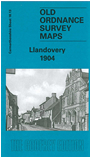
This detailed map gives very good coverage of the small town of Llandovery, with coverage extending northward to Llanfair Grange and the Roman station of Loventium.
Features include town centre with individual buildings neatly shown, Vale of Towy and Central Wales railway with station, St Dingat's church (at bottom margin), College, Cattle Market, castle remains, Town Mill, Broad Street, High Street, chapels, Workhouse, St Mary's church (at Llanfair Grange), Llanfair House, Tonn, Chain Bridge, Afon Towy, Blaenos, Llwyn-Howell, Picton Court, etc. On the reverse we include a 1906 directory of Llandovery, plus a railway timetable for the Llandovery-Llanelly line.