Old Ordnance Survey Maps of Cardiganshire or Ceredigion
We have a small range of detailed maps for Ceredigion towns, and we also cover the whole county at the Inch to the Mile scale.
All maps are available from our On-line Mapshop.
In 1974 Cardiganshire was abolished and it became Ceredigion District in the new Dyfed County Coun cil. Since 1996, however, it
has been a unitary council named Ceredigion. For a summary of the county's local government history visit This Page.
 These are the detailed maps we have published for Cardiganshire:
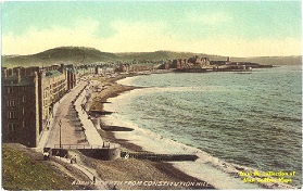
06.09 Aberystwyth 1904 - published 1989; intro by Sandra Wheatley.
18.12 Aberaeron 1904 - published 2006; intro by Alan Leather.
24.01 New Quay 1904 - published 2006; intro by Alan Leather
34.13 Lampeter 1904 - published 2002; intro by Alan Leather.
Also the following Pembrokeshire sheet:
2.12 Cardigan & St Dogmaels 1904 - published 2007; intro by Alan Leather.
 We also cover the whole of Wales in our Inch to the Mile series. Here are the principal sheets for Cardiganshire:
163 North Cardiganshire 1909 - published 2001; intro by Alan Leather. Includes a map of Borth.
177/194 Aberporth, Llangranog & District 1909 - published 2005, intro by Alan Leather. Includes detailed maps of Aberporth and Llangranog.
178 Mid Cardiganshire 1909 - published 2001, intro by Alan Leather. Includes a map of Llanrhystud.
193 Cardigan & District 1909 - published 2005; intro by Alan Leather. Includes a map of Llechryd.
195 Lampeter, Tregaron & District 1909- published 2002; intro by Alan Leather. Includes a map of Tregaron.
Visit the One Inch page for full details of this series.
 Most maps in the Godfrey Edition are taken from the 25 inch to the mile map and reduced to about 15 inches to the mile.
For a full list of Welsh maps, return to the Wales page
You can order maps direct from our On-line Mapshop.
Alan Godfrey Maps, Prospect Business Park, Leadgate, Consett, DH8 7PW. Tel 01207 583388
The Godfrey Edition / sales@alangodfreymaps.co.uk / 13 January 2017


 These are the detailed maps we have published for Cardiganshire:
 We also cover the whole of Wales in our Inch to the Mile series. Here are the principal sheets for Cardiganshire: