
 Here is information about Sheet 193:
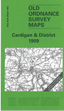
This Inch to the Mile map covers the coastal area of Cardiganshire and Pembrokeshire around Cardigan and St Dogmells. Coverage stretches from Pen-y-Bal and Moylgrove eastward to Cilgerran and Llangoedmor. There is, alas, rather a lot of sea on this map, but added interest is given on the reverse where we include an extract from Pembrokeshire Sheet 3.04, covering Llechryd in 1904, complete with a directory.
It is not possible to list the many hamlets, farmsteads and other topographical features shown on these maps. However, you may find it useful if we list the towns and principal villages or church parishes that are included on this map. Links are given for those for which detailed large-scale maps are also available.
Index maps are available showing the areas covered by the Inch to the Mile maps. Go to This page
You can order maps direct from our On-line Mapshop. For a full list of Inch to the Mile maps go to the Inch to the Mile page, where you will also find details of prices. For information on the rest of the series, go to The Index Page.