
 Here are the details of maps for Aberdeen (South):

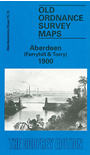
This detailed map covers an area to the south of the city centre, including Ferryhill, with coverage running from Irvine Place eastward to Torry Hill, and from Springbank Terrace southward to Duthie Park.
Features include: railway with Ferryhill Junction, engine sheds, Holburn Street station, Craiginches Siding; River Dee, Wellington Bridge, Victoria Bridge, St Fittrick's church, Victoria Bridge Ground, Craiginches area, Duthie Park, Devenha Brewery, Devenha House, Ferryhill House, Allenvale Cemetery, part of Ruthrieston, House of Bethany, Nellfield Cemetery, Holburn Street area, Clayhills, etc. On the reverse we include a selection of street directory entries, including Ferryhill Place/Terrace, Fonthill Road, Hardgate, Holburn Street, Menzies Road, Polmuir Road, Portland Street.
The map links up with Aberdeenshire sheet 75.11 Aberdeen to the north, 75.14 Mannofield to the west.