Old Ordnance Survey Maps of Aberdeen

  • These detailed maps normally cover an area of about one and a half miles by one mile. Each map includes an introduction.
  • They are available through our On-line Mapshop

  • Here are the details of maps for Aberdeen (W):

  • Aberdeenshire Sheet 75.10 Aberdeen (Queen's Cross) 1900 - published 1992; intro by John Smith. ISBN.978-0-85054-536-4

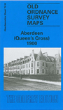
    This detailed map covers the western part of Aberdeen, with coverage stretching from Belvidere Street westward to Summerfield, and from Westburn Road southward to Stanley Street.

    Features include much of Rubislaw Ward, Victoria Park, Loch-head House, Rubislaw Den, tramways and depot, Queen's Cross, Morningfield Hospital, North Rubislaw, Raeden House, Oakbank Industrial School, Hill of Rubislaw, Woodhill House, and all the houses in this residential area neatly delineated.

    The map links up with Aberdeenshire sheet 75.11 Aberdeen to the east, 75.14 Mannofield to the south.


  • Follow this link for a complete list of our Aberdeenshire maps.
  • You can order maps direct from our On-line Mapshop. For other information and prices, and other areas, go to The Index Page.
  • Maps in the Godfrey Edition are taken from the 25 inch to the mile map and reduced to about 15 inches to the mile. For a full list of maps for Scotland, return to the Scotland page.
    The Godfrey Edition / sales@alangodfreymaps.co.uk / 6 Nov 2016