
 Here are the details of maps for Mixenden:

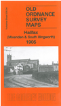
This detailed map covers the NW area of Halifax which includes parts of Mixenden, Illingworth, Ovenden and Wheatley.
Features include Illingworth church (split by north margin, Illingworth Mills, Forest Mills, Watkinson Hall Farm, Prospect Mill, tramways, Halifax High Level Branch railway, Page Hill, Hebble Valley, Mason's Green, Jumples, Ramsden Wood Reservoir, Delf Hill, Grindlestone Bank, Mixenden Lane Ends, Slippy Lane Farm, Jumples House, Box Trees Mill, Webster's Maltings, Wheatley Dyeworks, Wheatley Lane Ends, Ovenden Wood Brewery, Clough Brewery etc. An 1889 directory for Mixenden, Wheatley and Ovenden is included on the reverse.
The map links up with Sheets 231.01 Ovenden Cross to the east, 230.08 Halifax NW to the south.
You can order maps direct from our On-line Mapshop. For other information and prices, and other areas, go to The Index Page.
Maps in the Godfrey Edition are taken from the 25 inch to the mile map and reduced to about 15 inches to the mile. Follow this link for a complete list of our Calderdale maps; or here for the whole Yorkshire series.
Alan Godfrey Maps, Prospect Business Park, Leadgate, Consett, Co Durham, DH8 7PW / sales@alangodfreymaps.co.uk / 20 Sept 2016