Old Ordnance Survey Maps of Leeds

  • These detailed maps normally cover an area of about one and a half miles by one mile. Each map includes an introduction.
  • They are available through our On-line Mapshop

  • Here are the details of maps for Farsley:

  • Yorkshire Sheet 202.14 Farsley 1915 - published 2008; intro by Ruth Strong. ISBN.978-1-84784-212-1

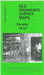
    This detailed map covers the small town of Farsley, west of Leeds. Most of the town centre is shown, and coverage includes Farsley Beck Bottom and Bagley, continuing north to the western tip of Rodley and westward to Woodhall Hill. Features include Sunny Bank Mill, St John's church (at foot of map), Springfield Mills, The Green, Bank Bottom Mills, Wadlands Hall, Holly Park Mills (near top left corner), Peel Ings Foundry, Broom Mills etc. On the reverse we include a 1922 directory of Farsley.


    The map links up with Sheets 202.10 Calverley to the north, 202.15 Bramley North to the east and 217.02 Stanningley to the south..


  • Follow this link for a complete list of our Bradford or Leeds area maps; or here for the whole Yorkshire series. You can order maps direct from our On-line Mapshop. For other information and prices, and other areas, go to The Index Page.
  • Most maps in the Godfrey Edition are taken from the 25 inch to the mile map and reduced to about 15 inches to the mile.
    For a full list of maps for England, return to the England page.
    Alan Godfrey Maps, Prospect Business Park, Leadgate, Consett, Co Durham, DH8 7PW / sales@alangodfreymaps.co.uk / 8th August 2017