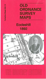
Yorkshire Sheet 202.13 Eccleshill 1892 - published 2010; intro by Ruth Strong. ISBN.978-1-84784-443-9 
This detailed map covers the village of Eccleshill, east of Bradford, together with the western fringe of Calverley. Coverage stretches from Undercliffe Road eastward to Woodhall Plantation, and from Wellington Road northward to Bank Top.
Features include GNR railway with Eccleshill station, St Luke's church, Union Mills, Fagley Quarry, Woodhall Plantation, Ravenscliffe Wood, Tunwell Mills, Old Mill, Holdsworth Square, Manor Potteries,
Gatehouse Farm, Moorside Mill, Radfield Quarry etc. On th reverse we include an 1889 directory of Eccleshill.
The map links up with sheet 202.09 Idle to the north, 201.16 Bolton Woods to the west, 202.14 Farsley to the east and 217.01 Thornbury to the south..
You can order maps direct from our On-line Mapshop.
For other information and prices, and other areas, go to The Index Page.
Maps in the Godfrey Edition are taken from the 25 inch to the mile map and reduced to about 15 inches to the mile.
Follow this link for a complete list of our Bradford maps; or here for the
whole Yorkshire series.
Alan Godfrey Maps, Prospect Business Park, Leadgate, Consett, Co Durham, DH8 7PW / sales@alangodfreymaps.co.uk / 15 November 2017

 Here are the details of maps for Eccleshill: