 Here are the details of maps for Middlesbrough Cargo Fleet

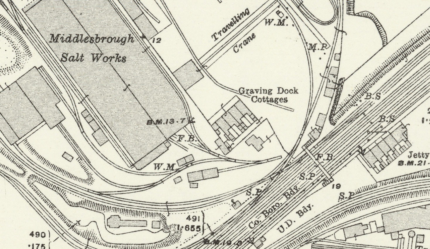
This detailed map covers the industrial area east of Middlesbrough, on both sides of the River Tees.
Features include the Clarence Ironworks, Salt Works, Clarence Old Cottages, Middlesbrough Dock, Cargo Fleet Ironworks, Tees Iron Works, Normanby Ironworks, Ormesby Ironworks. The map is notable for its maze of railway sidings and lines in and around the various ironworks, all shown in remarkable detail.
The map links up with Yorkshire Sheets 6.10 Middlesbrough North to the west, 6.12 South Bank to the east, and 6.15 North Ormesby to the south.
Further information:
This map is completely dominated by the industry that lined both sides of the Tees. On the Port Clarence side are the great iron and steel works established by Bell Brothers and later taken over by Dorman Long. Amazingly, near the heart of this industrial complex were back-to-back houses, the Clarence Old Cottages shown on the map, whose occupants would be visited by Florence Bell, author of At the Works. Later her stepdaughter, Gertrude Bell, the 'Desert Queen', would show lantern slides of her travels to the wives of Clarence. Across the river a string of other works, lesser only by comparison, lined the shore: The Tees Side Engine Works, Tees Ironworks, Ormesby Ironworks, Normanby Ironworks, Cargo Fleet Works, together with wharves and docks, most notably the Middlesbrough Dock, whose entrance dock is shown here. Very few people actually lived on this map, but thousands worked here in one of England's great industrial gatherings. Florence Bell - Lady Bell from 1904 - described the working conditions: 'The path of the ironworker is literally strewn with danger, for as he walks along, the innocent-looking fragment, no longer glowing, may be a piece of hot iron from which the touch, if stepped upon, is enough to cripple him; one splash of the molten iron may blind him; if he were to stumble as he walks along the edge of that sandy platform where the iron is bubbling and rushing into the moulds he would never get up again...'"

 .
.
"The next major firm was Normanby Ironworks, here with a frontage at Normanby Wharf, which was developed by Jones, Dunning & Co in 1859. By 1866 there were three blast furnaces and these were rebuilt in 1900, 1906 and 1923 respectively. Pease & Partners acquired a controlling interest c.1890 and the works continued into nationalisation in 1951. However, by 1959 much of the infrastructure, including the furnaces, was regarded as obsolete, making the works unsuitable for return to the private sector, and so it closed that summer, with around 465 losing their jobs. Local MPs complained in Parliament that “less than three weeks’ notice was given to the men, many of whom had worked almost the whole of their working lives at this plant."