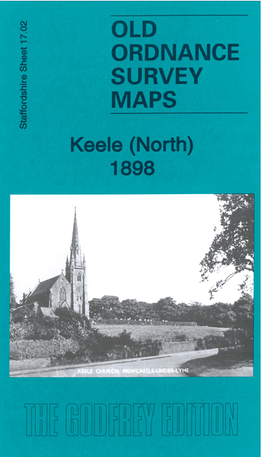
Staffordshire Sheet 17.02 Keele (North) 1898 - published 2023; intro by Barrie Trinder. ISBN.978-1-78721'601-3 
This detailed map covers the northern part of Keele with coverage extending northward to Finney Green, Silverdale Tileries, Silverdale Farm, and
Haying Wood. Featurs include St John's church, Top Farm, NSR Market Drayton line with Keele station, part of Audley Branch etc
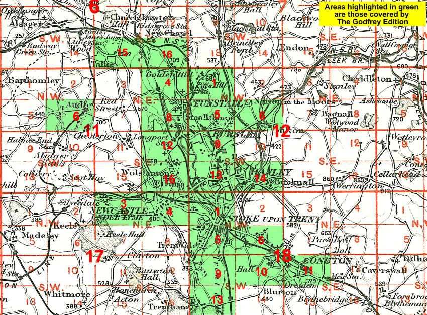
The map links up with Staffordshire Sheets 11.14 Scot Hay to the north and 17.03 Silverdale to the east.
You might find this Index Map useful.
For a full list of maps of Staffordshire, please go to the Staffordshire page or the
Potteries page.
You can order maps direct from our On-line Mapshop.
For other information and prices, and other areas, go to The Index Page.
Maps in the Godfrey Edition are taken from the 25 inch to the mile map and reduced to about 15 inches to the mile.
For a full list of maps for England, return to the England page.
Alan Godfrey Maps, Prospect Business Park, Leadgate, Consett, Co Durham, DH8 7PW /
sales@alangodfreymaps.co.uk / 27 November 2023
 Here are the details of maps for Keele: