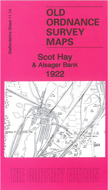
Staffordshire Sheet 11.14 Scot Hay & Alsager Bank 1922 - published 2023; intro by Barrie Trinder. ISBN.978-1-78721-704-1 
This detailed map covers the area around Scot Hay hamlet, with a post-industrial landscape that includes old mine workings and the tracks of old railways.
Features include Leycett station, Scot Hay, the southern part of Alsager Bank, Bates Wood, Bangup & Fair Lady Pits, Harrison & Woodburn Pit,
several railways.
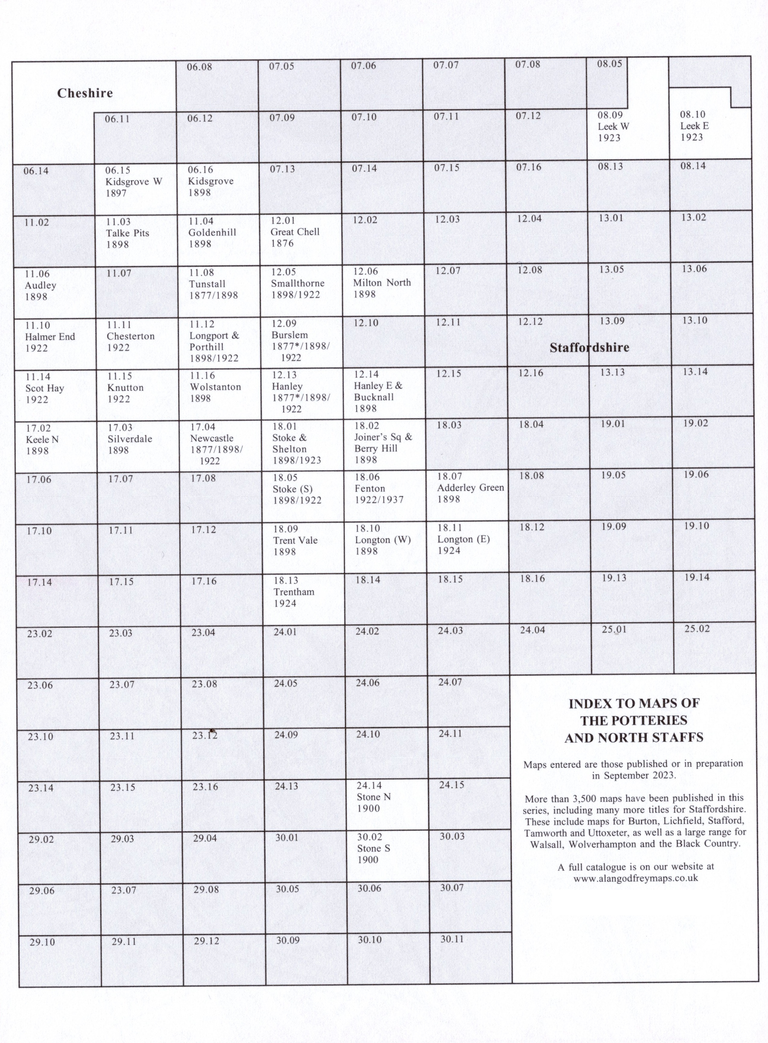
The map links up with Staffordshire Sheets 11.10 Halmer End to the north, 11.15 Knutton to the east
17.02 Keele North to the south.
You might find this Index Map useful.
For a full list of maps of Staffordshire, please go to the Staffordshire page or the
Potteries page.
You can order maps direct from our On-line Mapshop.
For other information and prices, and other areas, go to The Index Page.
Maps in the Godfrey Edition are taken from the 25 inch to the mile map and reduced to about 15 inches to the mile.
For a full list of maps for England, return to the England page.
Alan Godfrey Maps, Prospect Business Park, Leadgate, Consett, Co Durham, DH8 7PW /
sales@alangodfreymaps.co.uk / 27 November 2023
 Here are the details of maps for Scot Hay: