Old Ordnance Survey Maps of Renfrewshire

  • These detailed maps normally cover an area of about one and a half miles by one mile. Each map includes an introduction.
  • They are available through our On-line Mapshop

  • Here are the details of maps for Johnstone:

  • Renfrewshire Sheet 11.08 Johnstone 1895 - published 2005; intro by Gilbert Bell. ISBN.978-1-84151-823-7

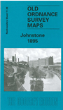
    This detailed map gives good coverage of central Johnstone and the area to the south, with coverage stretching from Gas Street and Johnstone Mill southward to Johnstone Castle.

    Features include GSWR railway with station, town centre with individual buildings neatly shown, iron foundries, Johnstone Castle, saw mills, cottage hospital, Barbush Mill, Old Mill, Hagg Mill, Nether Johnstone, Quarrellton, Greenend, Houston Square, Ludovic Square, Thornhill House, etc. On the reverse we include extracts from a trade directory.


  • Follow this link for a complete list of our Renfrewshire maps.
  • You can order maps direct from our On-line Mapshop. For other information and prices, and other areas, go to The Index Page.
  • Maps in the Godfrey Edition are taken from the 25 inch to the mile map and reduced to about 15 inches to the mile. For a full list of maps for Scotland, return to the Scotland page.
    The Godfrey Edition / sales@alangodfreymaps.co.uk / 11 November 2016