Old Ordnance Survey Inch to the Mile Maps

  • These maps normally cover an area of about 18 miles by 12 miles and are especially good at showing railways, roads and canals, and at giving a broad view of a wider area. Each includes an introduction and a more detailed map of a small town or village. They are available through our On-line Mapshop

  • Here is information about Sheet 296:

  • One Inch Sheet 296 Glastonbury & The Somerset Levels 1897 - published 2010; intro by Tony Painter. ISBN.978-1-84784-350-0

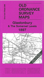
    This Inch to the Mile map covers an area of central Somerset, with coverage stretching from Middlezoy eastward to Castle Cary, and from Langport northward to Meare.

    Features include the towns of Glastonbury, Castle Cary, Langport and Somerton; stretches of the GWR and Somerset & Dorset lines, including much of the Burnham & Evercreech Jct line; King's Sedgemoor, Catcott Heath, etc. On the reverse we include a detailed map of the village of Evercreech, incl St Peter's church, Evercreech House, Weston Town, station (note this is not the junction station), Windy Farm etc.


    It is not possible to list the many hamlets, farmsteads and other topographical features shown on these maps. However, you may find it useful if we list the towns and principal villages or church parishes that are included on this map. Links are given for those for which detailed large-scale maps are also available.

  • Somerset: Alford, Aller, Ansford, Ashcott, Babcarry, Baltonsborough, Barton St David, Butleigh, Castle Cary, Catcott, Charlton Adam, Charlton Mackrell, Chilton upon Poden, Compton Pauncefoot, Curry Rivel, Ditcheat, Drayton, Drayton, Dundon, East Lydford, East Pennard, Edington, Evercreech, Glastonbury, Greinton, High Ham, Hornblotton, Guish Episcopi, Kingsdon, Kingweston, Langport, Long Sutton, Lovington, Meare, Middlezoy, Moorlinch, Muchelney, North Barrow, North Cadbury, North Wootton, Othery, Pilton, Pitney, Podimore, Pylle, Queen Camel, Shapwick, Somerton, South Barrow, South Cadbury, Sparkford, Stawell, Street, Sutton Mallet, Sutton Montis, Walton, West Bradley, West Camel, West Lydford, West Pennard, Weston Bampfyde, Wheatill.

    Index maps are available showing the areas covered by the Inch to the Mile maps. Go to This page


    You can order maps direct from our On-line Mapshop. For a full list of Inch to the Mile maps go to the Inch to the Mile page, where you will also find details of prices. For information on the rest of the series, go to The Index Page.


    Alan Godfrey Maps, Prospect Business Park, Leadgate, Consett, Co Durham, DH8 7PW / sales@alangodfreymaps.co.uk / 16 April 2011