
 Here is information about Sheet 274:
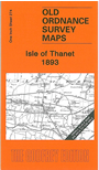
This map covers most of the Isle of Thanet, including the major towns of Margate, Ramsgate and Broadstairs. On the reverse we include a detailed map of the historic village of Minster.
It is not possible to list the many hamlets, farmsteads and other topographical features shown on these maps. However, you may find it useful if we list the towns and principal villages or parishes that are included on this map:
Index maps are available showing the areas covered by the Inch to the Mile maps. Go to This page
You can order maps direct from our On-line Mapshop. For a full list of Inch to the Mile maps go to the Inch to the Mile page, where you will also find details of prices. For information on the rest of the series, go to The Index Page.